
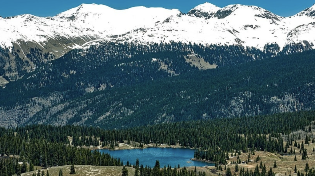
Rest and resupply towns near the CT are limited, but most offer some facilities a traveler will find useful (such as a post office or cafe), a place to resupply (though options may be limited), and, possibly, accommodations. The CT Databook is your best resource for resupply, and includes key information like the mile points where travelers would diverge from the CT, post office zip codes for general delivery shipments, place amenities, mileage from the trail to towns and road numbers. (Some resupply information is also available in The Official Guidebook to the Colorado Trail, Far Out- The Colorado Trail Hiker smartphone app, and websites such as Paul Magnanti’s end-to-end guide to the CT.)
Towns along The Colorado Trail are generally small but most offer some services.
Rest & Resupply Towns on the CT
Distance from the Trail ranges from within sight of the Trail (Copper Mountain and Princeton Hot Springs, for instance) to around 40 miles (Gunnison). Following is a list of the towns traveling southbound from Denver, including their approximate distance from Denver on the CT and from the Trail itself, and a brief description of services available:


Distance from the CT: Approximately 15 miles northwest on County Road 97; turnoff is at the junction of Segments 1 and 2.
This mountain town, not far outside Denver, straddles U.S. Highway 285 and offers a host of services. It is a long hitch from the trail on a lightly used county road.
For a comprehensive list of businesses in this town, check out the official Colorado Trail Guidebook.
Colorado Trail Guidebook
Get Your Business Listed
Sign up to get your business listed on this page by becoming a crew sponsor.
Distance from the CT: 3.2 miles northwest along County Road 126; turnoff is at about mile 10 of Segment 2.
Once a whistle stop on the Denver, South Park & Pacific Railroad. A few cabins, post office, small general store, pay phone, and Forest Service work center are located in the small town.
For a comprehensive list of businesses in this town, check out the official Colorado Trail Guidebook.
Colorado Trail Guidebook
Get Your Business Listed
Sign up to get your business listed on this page by becoming a crew sponsor.
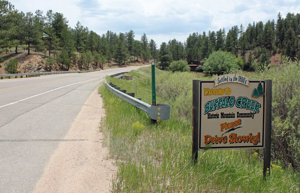
Distance from the CT: Approx. 8 miles northwest from the junction of Segments 3 and 4 and 18 miles from Kenosha Pass (Segments 5 and 6); turnoff is on Wellington Lake Road (Forest Service Road 560), which becomes County Road 68.
Up the road from Conifer on U.S. Highway 285. The town offers a small business center supported by dispersed mountain residences. It is the closest resupply point to Kenosha Pass.
Below are businesses in Bailey that donate to support The Colorado Trail Foundation’s efforts to maintain The Colorado Trail. For a comprehensive list of businesses in this town, check out the official Colorado Trail Guidebook.

Colorado Trail Guidebook
Get Your Business Listed
Sign up to get your business listed on this page by becoming a crew sponsor.
Distance from the CT: 4.5 miles southwest of Kenosha Pass, at the junction of Segments 5 and 6, on U.S. Highway 285.
Once a train stop, the town has a population of less than a couple dozen. A cafe is located in the town, but the Jefferson Market has closed. Do not anticipate sending a hiker box here. The nearest post office is Fairplay or Como.
For a comprehensive list of businesses in this town, check out the official Colorado Trail Guidebook.
Colorado Trail Guidebook
Get Your Business Listed
Sign up to get your business listed on this page by becoming a crew sponsor.
Distance from the CT: Approx. 20 miles southwest of Kenosha Pass at the junction of Segments 5 and 6.
Another 15 miles farther southwest of Jefferson on U.S. Highway 285 is this much larger (population: 700-plus) town. Services in the town include grocery and convenience stores, restaurants, post office, hotels and motels.
Below are businesses in Fairplay that donate to support The Colorado Trail Foundation’s efforts to maintain The Colorado Trail. For a comprehensive list of businesses in this town, check out the official Colorado Trail Guidebook.

Colorado Trail Guidebook
Get Your Business Listed
Sign up to get your business listed on this page by becoming a crew sponsor.
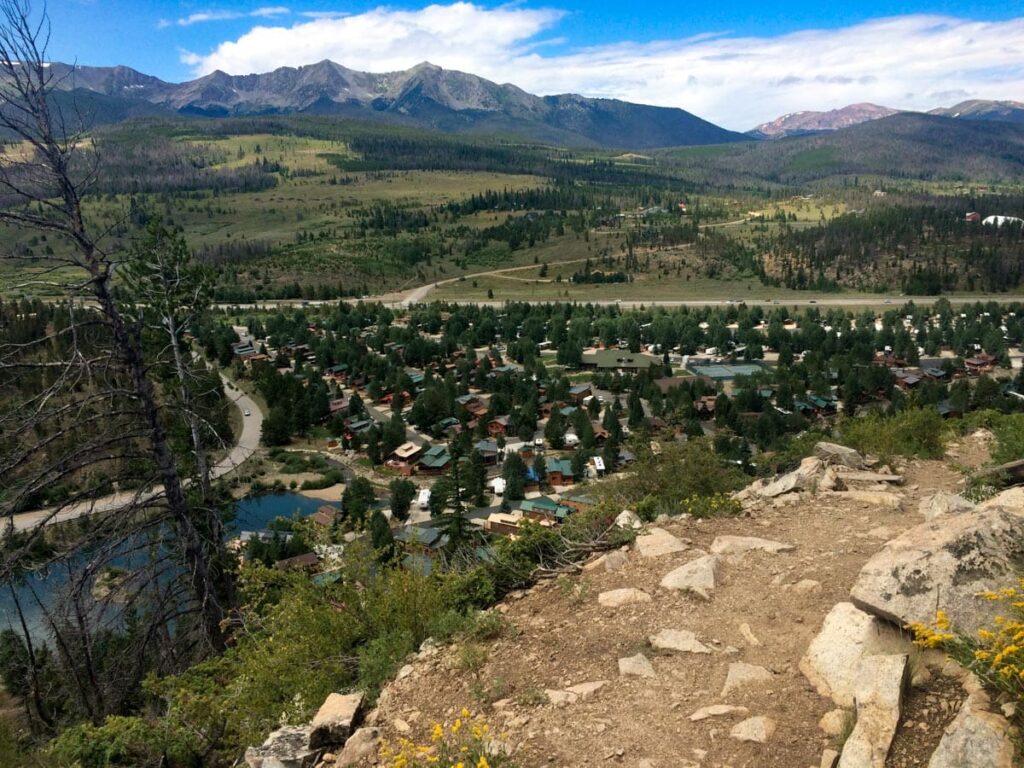
Distance from the CT: Breckenridge is approximately 4 miles south of the Gold Hill Trailhead on Colorado Highway 9 at the junction of Segments 6 and 7. Frisco is approximately 5 miles northwest of the trailhead.
The Colorado Trail meets real civilization here where it crosses the Blue River between Frisco and Breckenridge. You can catch a free Summit Stage bus to either town or to Copper Mountain Resort. There is a bus stop on Highway 9 about 0.2 miles south of the trailhead. Pick up northbound buses on the east side of the highway and southbound buses on the west side. Both towns are restored mining/railroad towns serving the popular year-round resorts of Summit County and have many services.
For a comprehensive list of businesses in this town, check out the official Colorado Trail Guidebook.
Colorado Trail Guidebook
Get Your Business Listed
Sign up to get your business listed on this page by becoming a crew sponsor.

Distance from the CT: Less than a mile to services.
The CT crosses the lower slopes of Copper Mtn ski area, making this one of the easiest resupply points. Not technically a town, but offering a range of services, including accommodations, shops and restaurants. There is a convenience store/gas station near Wheeler Flats Trailhead.
For a comprehensive list of businesses in this town, check out the official Colorado Trail Guidebook.
Colorado Trail Guidebook
Get Your Business Listed
Sign up to get your business listed on this page by becoming a crew sponsor.
Distance from the CT: Approx. 8 miles from either turnoff. From Tennessee Pass, at the junction of Segments 8 and 9, take U.S. Highway 24 south; from the Timberline Lake Trailhead, near the junction of Segments 10 and 11, take Turquoise Lake Road (Forest Road 105).
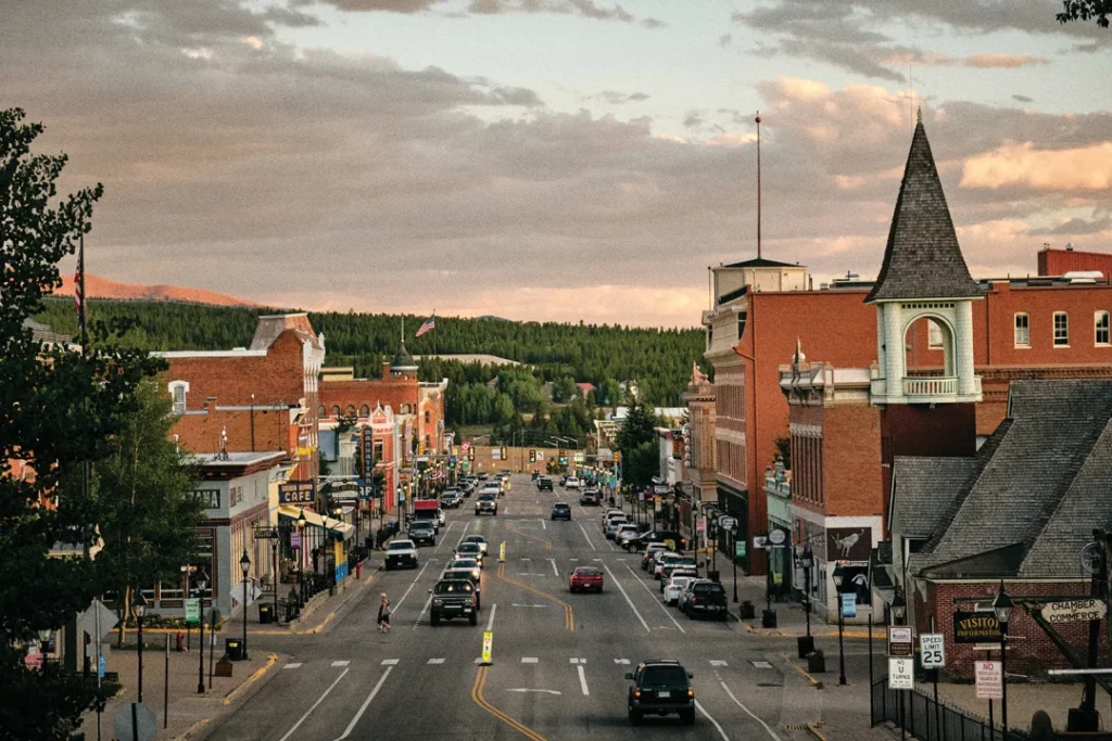
This is a historic mining and railroad town, and highest U.S. city at 10,200 feet. Distance from Denver is approx. 143 miles to Tennessee Pass; 156 miles to the Timberline Lake Trailhead. Leadville offers a full range of services, including accommodations, several restaurants, grocery stores and camping equipment shops.
For a comprehensive list of businesses in this town, check out the official Colorado Trail Guidebook.
Colorado Trail Guidebook
Get Your Business Listed
Sign up to get your business listed on this page by becoming a crew sponsor.
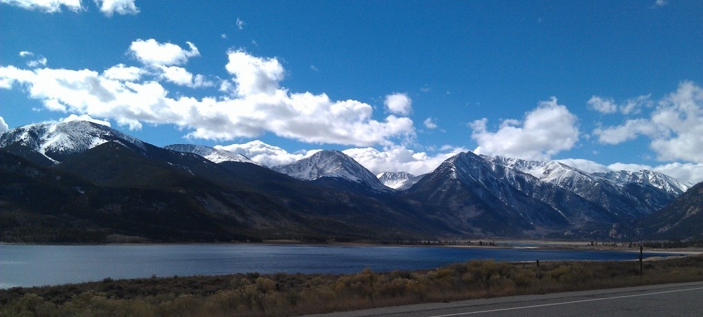
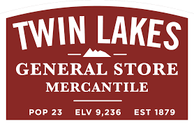
Distance from the CT: Approx. 1 mile west of where the Trail crosses Colorado Highway 82 at mile 7.2 Segment 11. There is also a small side trail that leads to the west side of the village beginning at mile 5.9 of Segment 11.
This old mining town is perhaps Colorado’s oldest resort town and features the Twin Lakes Store, a delightful old general store that provides a surprisingly helpful supply of items for CT travelers, and accommodations too. Note: About 7.5 trail miles south from Twin Lakes Village the CT splits into the Collegiate East and Collegiate West routes. There are limited resupply options on the West route until travelers reach U.S. Highway 50 near Monarch Pass.
Below are businesses in Twin Lakes Village that donate to support The Colorado Trail Foundation’s efforts to maintain The Colorado Trail. For a comprehensive list of businesses in this town, check out the official Colorado Trail Guidebook.
Colorado Trail Guidebook
Get Your Business Listed
Sign up to get your business listed on this page by becoming a crew sponsor.
Distance from the CT: Approx. 9.5 miles from the Avalanche Trailhead (mile 6.6 of Segment 13) east on Cottonwood Pass Road (County Road 306) to town. Another option is to exit the Trail at Clear Creek Canyon Road (County Road 390) at the end of Segment 11, travel east to U.S. Highway 24, and go south (total travel distance: 19 miles).
Located in the Arkansas Valley between the Mosquito Range and towering Sawatch Range, Buena Vista certainly lives up to its Spanish name (translation: good view). The town, one of the larger along the Trail, is an ideal resupply point for long-distance trekkers.
For a comprehensive list of businesses in this town, check out the official Colorado Trail Guidebook.
Colorado Trail Guidebook
Get Your Business Listed
Sign up to get your business listed on this page by becoming a crew sponsor.
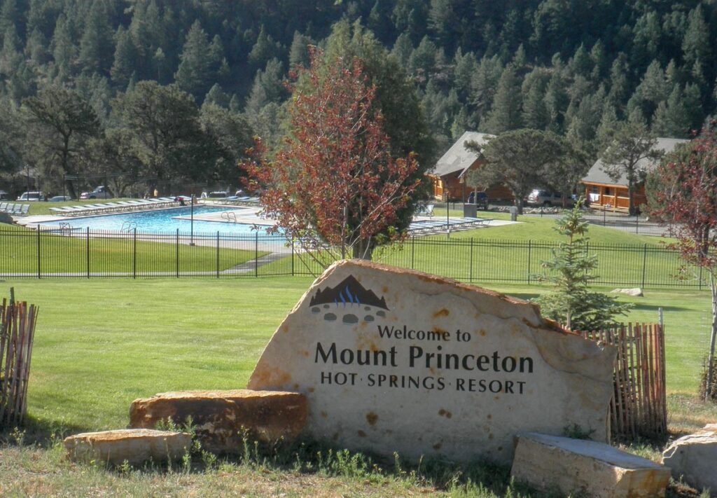
Distance from the CT: The Trail runs through the property.
This resort area offers a welcome respite to CT travelers. Features a hot springs pools, restaurant and overnight accommodations. There is also a small general store and maildrop.
For a comprehensive list of businesses in this town, check out the official Colorado Trail Guidebook.
Colorado Trail Guidebook
Get Your Business Listed
Sign up to get your business listed on this page by becoming a crew sponsor.
Distance from the CT: Salida is approx. 15 miles east of where the Collegiate East route crosses U.S. Highway 50 and about 22 miles from where the Collegiate West routes crosses Highway 50.
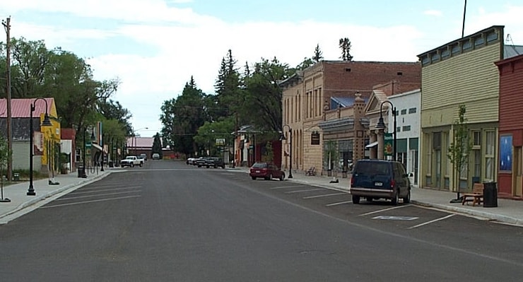
Salida, an old railroad town near the midpoint of The CT, is now a commercial center for the Arkansas Valley and a popular spot for travelers who want to take a break from the Trail. Salida’s vibrant downtown features shops, restaurants, and a variety of overnight accommodations both there and along the U.S. Hwy 50 commercial strip. The smaller Poncha Springs, on the the western outskirts of Salida, has a small restaurant and convenience store. Note both of these: The Monarch Spur RV Park, about a mile east of where the Collegiate East crosses Highway 50 (and about 9 miles from the Collegiate West crossing), has camping and showers. The Monarch Crest Gift Shop, a short hike north from where the Collegiate West route crosses Highway 50, has some groceries and a restaurant.
Below are businesses in Salida or Poncha Springs that donate to support The Colorado Trail Foundation’s efforts to maintain The Colorado Trail. For a comprehensive list of businesses in this town, check out the official Colorado Trail Guidebook.
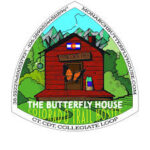
The Butterfly House – Hiker Hostel located on Monarch Pass, 2 Miles off CDT and CT.
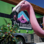
The FlaminGo Food Trailer – Homemade grab and go breakfast with locally roasted coffee.

Salida Mountain Sports – Welcome hikers! See us for all your gear and clothing needs.

The Lodge at Poncha Springs – We are perfectly located where adventure and cozy collide!
Colorado Trail Guidebook
Get Your Business Listed
Sign up to get your business listed on this page by becoming a crew sponsor.
Distance from the CT: Approx. 31 miles southeast on Colorado Highway 114, which the Trail crosses near the junction of Segments 17 and 18.
A small, but charming town of about 500, it can be a long hitch from the Trail. Offering restaurants, a coffee shop, lodging, and post office.
For a comprehensive list of businesses in this town, check out the official Colorado Trail Guidebook.
Colorado Trail Guidebook
Get Your Business Listed
Sign up to get your business listed on this page by becoming a crew sponsor.
Distance from the CT: 39 miles (total) northwest on Colorado Highway 114, which the Trail crosses near the junction of Segments 17 and 18, then west from where 114 intersects with U.S. Highway 50.
This town of about 6,000 is home to Western Colorado University and styles itself as “Base Camp of the Rockies” for its many outdoor recreational opportunities. As befits a town of its size, it boasts a full range of services and is a popular resupply point for CT travelers.
For a comprehensive list of businesses in this town, check out the official Colorado Trail Guidebook.
Colorado Trail Guidebook
Get Your Business Listed
Sign up to get your business listed on this page by becoming a crew sponsor.

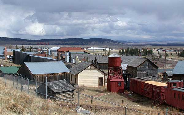
Distance from the CT: Approx. 10 miles from San Luis Pass at the intersection of Segments 20 and 21. Descend on a side trail south along the headwaters of West Willow Creek until you meet up with Forest Service Road 503, which leads into town. About two miles down 503 is the Equity Mine. This area is used by people climbing nearby San Luis Peak, hunters during hunting season, and people on a self-guided mine tour. On a busy weekend, a backpacker may find an easy hitch from the mine into town. Creede can also be reached, if with difficulty due to the 33-mile distance and low traffic, from the Spring Creek Pass Trailhead.
This historic mining town of about 300 is the only incorporated town in sparsely populated Mineral County. Despite its size, Creede is a popular tourist destination and offers a full range of services.
Below are businesses in Creede that donate to support The Colorado Trail Foundation’s efforts to maintain The Colorado Trail. For a comprehensive list of businesses in this town, check out the official Colorado Trail Guidebook.

4 hotel rooms, live music, great food. Come recharge here!
Colorado Trail Guidebook
Get Your Business Listed
Sign up to get your business listed on this page by becoming a crew sponsor.
Distance from the CT: Approx. 17 miles northwest of Spring Creek Pass, at the intersection of Segments 21 and 22, on Colorado Highway 149.
Another former mining town, and only incorporated town in Hinsdale County. This town has a full range of services, including restaurants, lodging, and grocery and convenience stores.
For a comprehensive list of businesses in this town, check out the official Colorado Trail Guidebook.
Colorado Trail Guidebook
Get Your Business Listed
Sign up to get your business listed on this page by becoming a crew sponsor.
Distance from the CT: Right off the Trail at mile 18.7 of Segment 24.
Not a town, but a campground. Offers showers, limited grocery items, and a mail drop.
For a comprehensive list of businesses in this town, check out the official Colorado Trail Guidebook.
Colorado Trail Guidebook
Get Your Business Listed
Sign up to get your business listed on this page by becoming a crew sponsor.
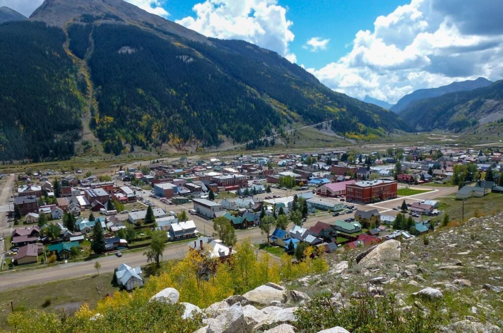
Distance from the CT: Approx. 6 miles north of Molas Pass on U.S. Highway 550, which the CT crosses at the split between Segments 24 and 25.
The last good resupply stop before arriving in Durango. A short hitchhike down from Molas Pass, or you may be able to catch a train from the trail. As the terminus of the popular Durango & Silverton Narrow Gauge Railroad, Silverton is a popular with tourists and offers a full range of services. Note: Molas Lake Campground is just 0.2 mile from the CT and southbound travelers can diverge at the sign as they approach Molas Pass. The tiny campground store has snacks. A shower is possible (bring your own towel) and the campground will accept and hold maildrop resupply packages shipped via UPS.
Below are businesses in Silverton that donate to support The Colorado Trail Foundation’s efforts to maintain The Colorado Trail. For a comprehensive list of businesses in this town, check out the official Colorado Trail Guidebook.
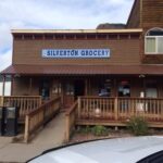
A locally owned grocery store with all your trail needs and a Deli!
Colorado Trail Guidebook
Get Your Business Listed
Sign up to get your business listed on this page by becoming a crew sponsor.

Distance from the CT: need info
Durango is the proud southern terminus or start to The Colorado Trail. With a historic downtown, the Animas River, and a full range of services, there is no shortage of options to fill your time after completing or before starting The CT.
Below are businesses in Durango that donate to support The Colorado Trail Foundation’s efforts to maintain The Colorado Trail. For a comprehensive list of businesses in this town, check out the official Colorado Trail Guidebook.
Thru-hiker owned, classic diner. 10% off for CT finishers.
The unofficial end! Finish with a free Colorado Trail Ale.
Colorado Trail Guidebook
Get Your Business Listed
Sign up to get your business listed on this page by becoming a crew sponsor.
Want to have your business on this page? Click here to learn more and sign up!
Trail Shuttlers
The Foundation maintains a list of shuttle drivers – both individuals and businesses – in Denver and towns along the Trail who have offered to help travelers get to and from trailheads. Click below to learn more.
Travel Essentials
If you plan to hike, bike, ride, walk, or run the Trail, whether a day hike or a summer-long adventure, make sure to dive into the essential travel resources on this website.

